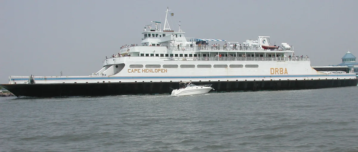
About 85 minutes, across 17 miles of open water, between two capes that face each other across the mouth of Delaware Bay. That is the answer most people are looking for. The rest of this page is what is underneath you while you do it.
Eighty-five minutes, seventeen milesThree vessels run this route: Cape Henlopen, Delaware and New Jersey. This is the Delaware, off Lewes.Photograph by Acroterion, May 2019, via Wikimedia Commons. Cropped and resized; reused under CC BY-SA 4.0.
The short answers
| How long is the crossing? | Roughly 85 minutes dock to dock, weather depending. |
|---|---|
| How far? | 17 miles. |
| How wide is the bay mouth? | About 10 miles between the two capes, by NOAA's reckoning. The route is longer than the gap because the terminals are not on the tips. |
| Who runs it? | The Delaware River and Bay Authority, a bi-state agency created in 1962. |
| Since when? | First voyage July 1, 1964. |
| Can I bring a dog? | Yes, and there is no pet fee. He can ride in the vehicle or come up on the exterior passenger decks on a leash — not into the indoor lounges or anywhere food is served, except in bad weather and in winter. Both terminals have grass to use before boarding. Dogs at Cape Henlopen. |
Schedules, fares and reservation rules change with the season and this site does not publish them. Get those from the ferry's own site.
There is a game for this crossing
Eighty-five minutes is a long time to sit. Cape Henlopen: The Surrender is a history game you play on this boat, on the water it happened on — the four years men watched this bay, and the German submarine that surfaced at the end of it and gave herself up. One pass covers up to six devices, and you never have to leave your seat.
See what it is →Neither end is in the town it is named after
This catches out more people than anything else about the trip.
The Delaware terminal is on Cape Henlopen Drive, out on the cape itself, about two and a half miles from downtown Lewes. The New Jersey terminal is at North Cape May, in Lower Township, about four miles from Cape May City.
The ferry is named for the two destinations people want to reach, not the two pieces of ground it actually lands on. If you are walking on without a car, plan for that gap at both ends.
What it is really doing is joining two capes. NOAA's Coast Pilot describes the entrance to this bay as running about 10 miles wide between Cape May on the northeast and Cape Henlopen on the southwest. The official description of this water was cape-to-cape long before the boat existed.
What is under the boat
Delaware Bay is a shallow platter with one deep gouge cut through it.
| Deepest point on the ferry route | About 135 feet, roughly five miles out of Lewes |
|---|---|
| The dredged shipping channel | 45 feet |
| Either side of the channel | 20 to 50 feet, mostly nearer 30 |
| Overfalls Shoal | About 8 feet |
That is worth sitting with for a moment, because it decided a war. A submarine cannot hide in most of Delaware Bay. In much of it a submarine cannot even submerge. Everything that was built on these two capes in the 1940s — the guns, the towers, the mines, the bunkers — was built around that one fact about the water you are crossing.
The first attempt at this crossing failed
The ferry you are on started running in 1964. Somebody tried it thirty-eight years earlier and it went badly.
In 1926 a syndicate bought a surplus concrete ship and planned to sink her off Cape May Point as the foundation of a ferry pier for exactly this route. She would not stay where they put her. The wreck is still there, a hundred and fifty feet off Sunset Beach, and you can go and look at what is left of her.
The state line you cannot see
Somewhere in the middle of this crossing you pass from Delaware into New Jersey, and there is nothing whatsoever to mark it. No buoy, no change in the water, nothing.
Which is fitting, because the boundary out here has been argued over for three centuries and the argument was never really about the water.
Both ends of the crossing
This site covers both capes, because the story only makes sense with both.
Cape Henlopen — Delaware
A five-thousand-acre hook of sand with beaches on two bodies of water and an army fort buried in the dunes.
Cape May Point — New Jersey
A borough of a third of a square mile at the tip of New Jersey, facing back down the bay.
How the ferry came to exist
A feasibility study in 1963 said the crossing would work. The Delaware River and Bay Authority — created the year before to run bi-state crossings — started the service on July 1, 1964, with secondhand vessels bought off the Chesapeake rather than purpose-built ones.
Since then the ferry has carried more than 17 million vehicles and 50 million passengers. It is now the thing that makes the two capes one place instead of two.